The first time that I experienced Mt. Makiling was more than ten years ago. After my first climb, it became my concept that Makiling was a Limatik and Lipa (lingatong as we call it in our province) infested mountain... more of a “Good Friday” hiking destination than a place to experience the vibrant and rejuvenating atmosphere of nature. For so long, I did not return to Makiling until one day I discovered that all the uncomfortable memories is gone and now, I am ready to visit the mountain again.
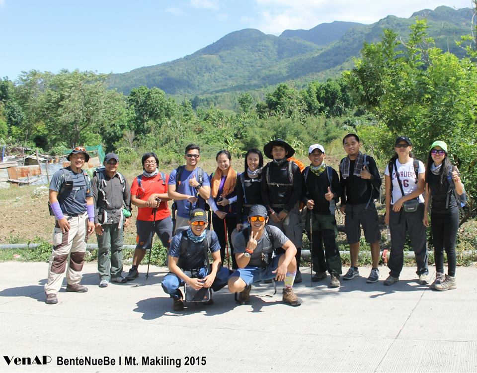
My Mt. Apo friends; Ma’am Ven, Sir Gil, Sir Glenn and others decided to have a reunion climb… after series of long discussions, we decided to choose Mt. Makiling. After realizing that only four of us would be available on April 25, 2014, we decided to invite others friends to be with us. Conversely, I learned that a small group from Cavman Mountaineers were likewise planning to climb on the same date; I proposed that together, we shall be climbing Mt. Makiling. Positively, Cavman through Joel Lacanaria, a young and passionate mountaineer; gave a nod for the joint climb. Makiling opened anew door to meet new friends with the similar heart for rough terrain!
April 25, 2015; our group assembled at Barangay San Felix in Sto. Tomas at around 10:00 AM (specifically at Highway-MakBan Geothermal Road Junction). Via tricycle, we went to the “eco-park” (or dumpsite as tricycle drivers call it) to register. There was no registration fee but a mandatory guide was required. Guide rate was at 100 pesos per climber.
I climbed Mt. Makiling before via Maria Makiling trail in UPLB with a friend who lives in Los Banos, we did not register and instead sneaked via certain route that connects to the Maria Makiling trail. It was my impression, that at present, the manner of managing this rugged terrain is far better than before.
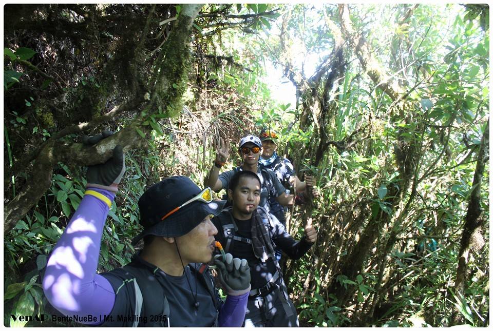
We started trekking at around 10:30 under scorching summer sun; initially, in a wide road with large pipes of the Geothermal Plant Complex on the background. After 20 minutes, we entered into a narrower but clean trail… few meters away from a production well of the Geothermal Plant Complex. I assumed that this was the trailhead of Sipit Trail. We passed through slightly vegetated land and saw some local farmers doing ‘kaingin’- actually in the process of burning some cleared vegetation. According to our guides, the kaingin was still outside the protected area.
After few minutes, we found ourselves counting the number of stations until we reached station 5 were we had rest and refilled our bottles with water. From station 5, the trail was still generally gradual except for few steep but manageable parts nearing stations 10 to 13. While on our way, some mountain newbies with eager hearts of completing the traverse climb suffered from cramps, luckily ‘whiteflower’ together with their will to push and complete the adventure did not boiled their energy.
We continuously ‘counted’ the number of stations through generally easy up and few down forested trails until we reached station 15, our designated lunch stop. According to the guides, this station is the end of the generally gradual trail and the start of a more serious journey. We had a chance to share some bits of our food and to exchange few stories.
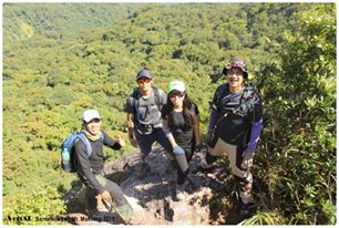
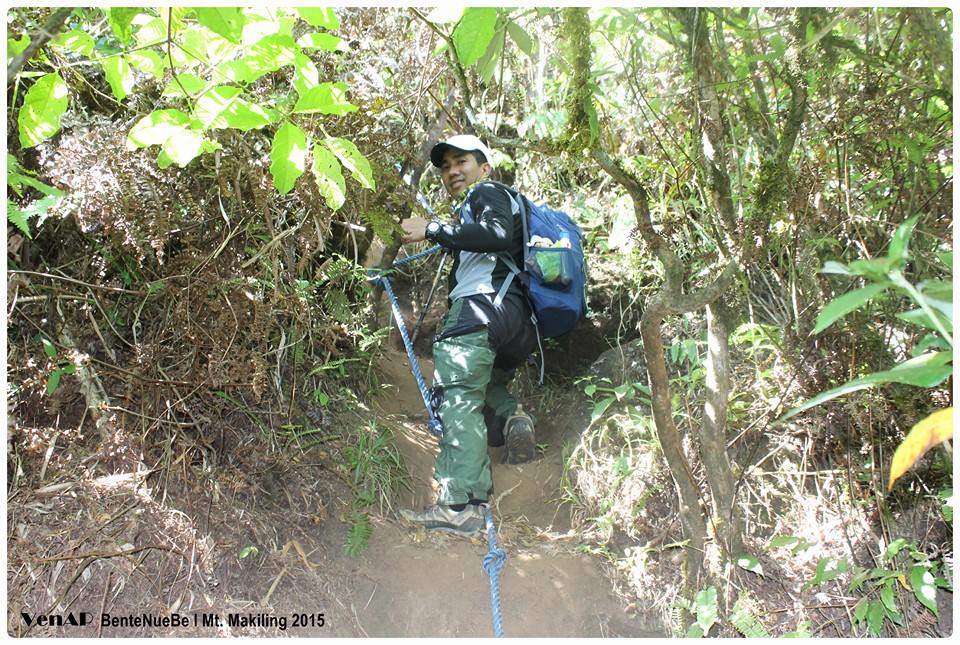
After an hour of rest, we started the steep assault to Peak 3. This was probably the most difficult and dangerous part of the trail. For me, it was still manageable… the ropes which was placed along the steep parts of the trail was very help. At this part of the venture, the picturesque view of the landscapes of Batangas, Laguna and perhaps Quezon provinces will surely pacify the boggling pulse rate of climbers due to fatigue and fear of heights. We consumed a lot of times not just for grappling and rappelling (I am not sure if this term is right) but also in taking more and more and more pictures. We reached peak 3 (in my altimeter reading, the peak was 1,090 MASL) after an hour and a half.
I climbed Mt. Makiling before via Maria Makiling trail in UPLB with a friend who lives in Los Banos, we did not register and instead sneaked via certain route that connects to the Maria Makiling trail. It was my impression, that at present, the manner of managing this rugged terrain is far better than before.
We started trekking at around 10:30 under scorching summer sun; initially, in a wide road with large pipes of the Geothermal Plant Complex on the background. After 20 minutes, we entered into a narrower but clean trail… few meters away from a production well of the Geothermal Plant Complex. I assumed that this was the trailhead of Sipit Trail. We passed through slightly vegetated land and saw some local farmers doing ‘kaingin’- actually in the process of burning some cleared vegetation. According to our guides, the kaingin was still outside the protected area.
After few minutes, we found ourselves counting the number of stations until we reached station 5 were we had rest and refilled our bottles with water. From station 5, the trail was still generally gradual except for few steep but manageable parts nearing stations 10 to 13. While on our way, some mountain newbies with eager hearts of completing the traverse climb suffered from cramps, luckily ‘whiteflower’ together with their will to push and complete the adventure did not boiled their energy.
We continuously ‘counted’ the number of stations through generally easy up and few down forested trails until we reached station 15, our designated lunch stop. According to the guides, this station is the end of the generally gradual trail and the start of a more serious journey. We had a chance to share some bits of our food and to exchange few stories.
After an hour of rest, we started the steep assault to Peak 3. This was probably the most difficult and dangerous part of the trail. For me, it was still manageable… the ropes which was placed along the steep parts of the trail was very help. At this part of the venture, the picturesque view of the landscapes of Batangas, Laguna and perhaps Quezon provinces will surely pacify the boggling pulse rate of climbers due to fatigue and fear of heights. We consumed a lot of times not just for grappling and rappelling (I am not sure if this term is right) but also in taking more and more and more pictures. We reached peak 3 (in my altimeter reading, the peak was 1,090 MASL) after an hour and a half.
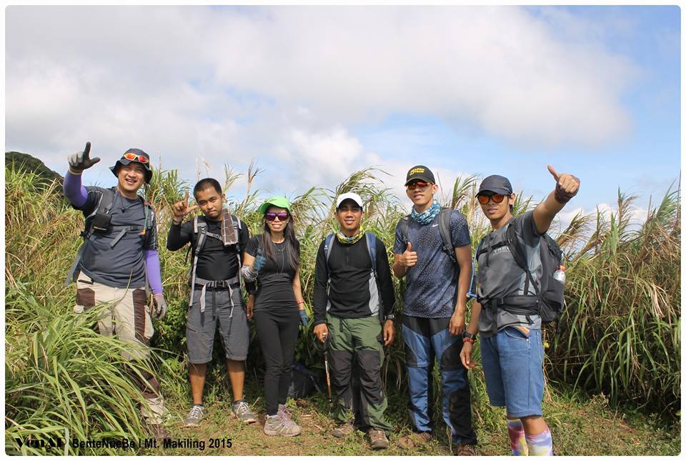
From Peak 3, we passed through densely covered ridge that is between 1,020 to 1,090 MASL until we had a sudden descend to around 950 MASL prior to Peak 2, the highest point. According to the guide, the ridge was the most limatik infested part of the trail… but I only encountered one ‘loner’ gray limatik. From the start of the trekking, probably, at this portion, we are at the peak of our laughter and noise because we keep on counting the number head bumps. It turned out to be a battle between Glenn and Renz. As we approached peak 2, the highest point; it was Glenn who had the most number of bumps but there was a last minute bumps few meters away from the peak that made the score even!
After 20 minutes of rest at the summit, we started descending via Maria Makiling; this time, there was a sudden change of mood. Everyone was so serious, perhaps at this point, all were physically tired after seven hours of trekking. Compared to the clean and primeval state of the Sipit trail, Maria Makiling trail is bit littered, wider and eroded. We arrived in ‘Aguila Post’ after two more hours exhausted but joyful and fulfilled. We had a ‘habal-habal’ ride down to Maria Makiling trail registration point and immediately tidied ourselves and went back to our respective places.
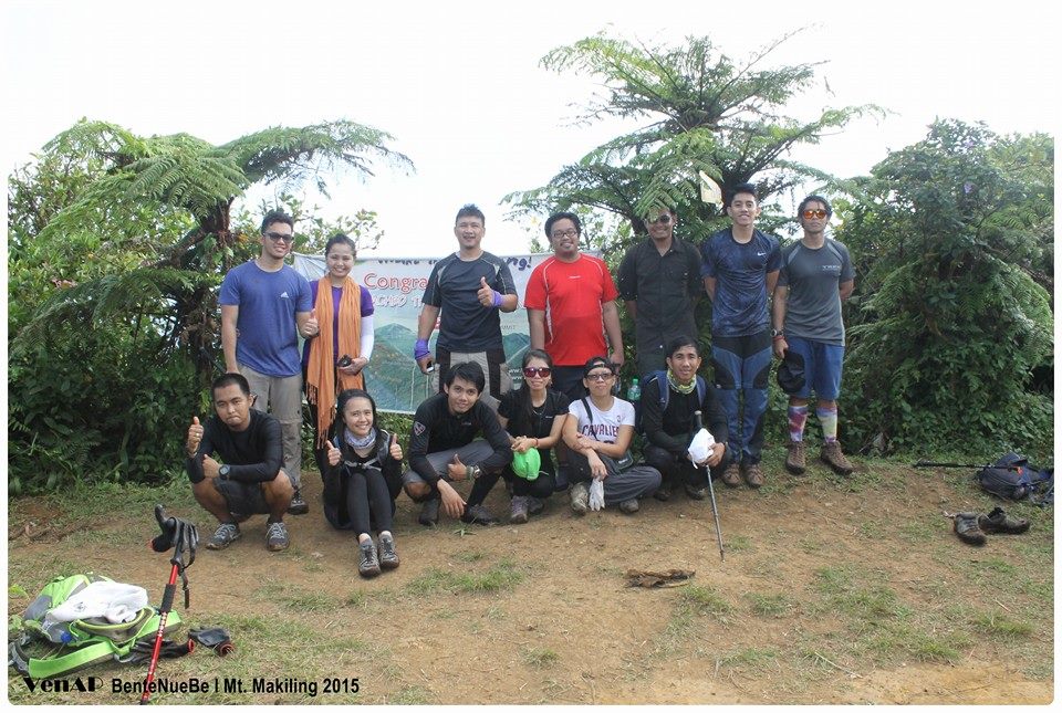
Now I have a very beautiful memories of Mt. Makiling, and hopeful to be with this mountain again soon with similarly jolly companions. What made our Makiling adventure aside from its natural and captivating beauty is the eagerness to meet old friends and openness to meet and be with new people… to cherish old friendship and to ignite new ones. For us, Mt. Apo friends, Mt. Makiling bonded us more firmly together… we are no longer just Mt. Apo friends but real friends.
... thanks 'Ven Ap', my good friend for allowing me to use the photos
 RSS Feed
